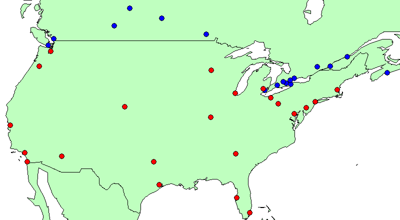
This is the base map of major centres to be used. To highlight differences yet maintain clarity, only Canadian cities >200,000 population are shown. Using the principle of "10-to-1", where most comparisons between Canada and the United States can be made by multiplying a Canadian figure by 10, only American cities >2,000,000 population are examined. Surprisingly, this resulted in an almost equal number of cities on both sides of the border. Not surprisingly, however, it also shows that, while Canada's major cities are almost entirely concentrated into the small strip of land between Quebec City and Windsor (<2% of the nation's land mass), America's are dispersed almost evenly throughout the country :
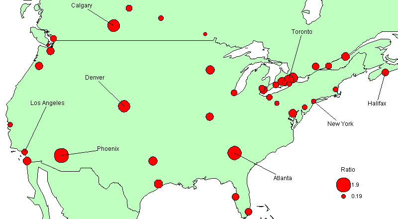
This map plots the latest housing data -- newly constructed housing units "started" in the month, per 1,000 population. In the case of Canada, this reflects actual footings in the ground, April 2000. For the U.S., it is building permits issued, March 2000 (on the assumption that house and apartment construction is usually started the following month) :
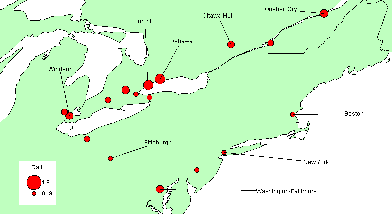
The next map shows the two nations' respective heartlands, the Corridor in Canada, the Eastern Seaboard in the U.S. Clearly Canada's heartland is outpacing that of the U.S. While the whole Northeastern U.S. is generally sluggish, Southern Ontario is booming. Even Quebec City exceeds most U.S. heartland centres :
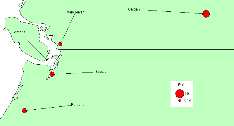
The following map depicts 2 hinterland areas in the U.S. and Canada that are adjacent to each other. It appears that there is not much difference between the two countries, when netted-out, though within Canada there are more extremes (Calgary vs Victoria). The West Coast, on both sides of the border, is still languishing :