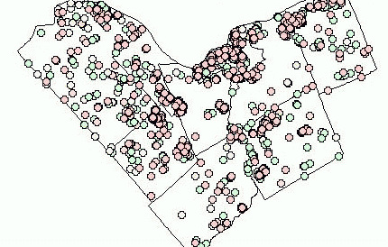
Here is
the base map of 5 years of housing data in Ottawa-Carleton. Each
dot represents a "completion" (a single or semi-detached house whose construction
was completed in the given year). The colours represent the year
of completion. Click this map to begin the process of stepping-through
from 1994 to 1998 (clicking each subsequent map steps you through each
year). Clicking the last map will bring you back to the Case-Studies
page.