GIS 8746 - Assignment #1 - Winter '99
 

For this assignment, setup an Idrisi environment (ENVIRON) on your N: drive (this is your private network drive).

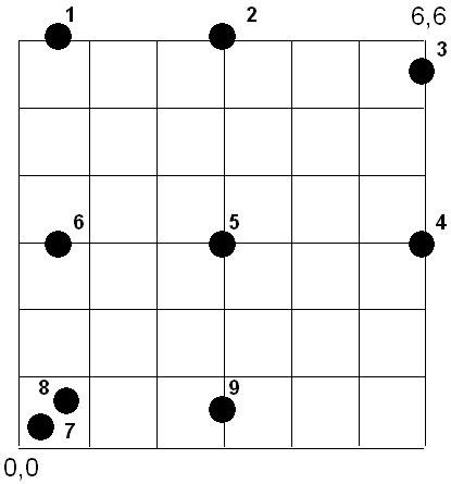
  1. Using ASCII files, create a point file (using Notepad, Wordpad, or Word, etc.) to test how Idrisi handles the following ambiguous conditions when it rasterizes the point file.

  2. a) Provide the contents of the ASCII point file you used and a snapshot of the final raster image with the point overlay.
    b) For each point, describe how Idirisi rasterized the vector data.

    NOTE:
    You will have to use CONVERT to convert the ASCII point file to binary format before you can rasterize or display the point vector file.


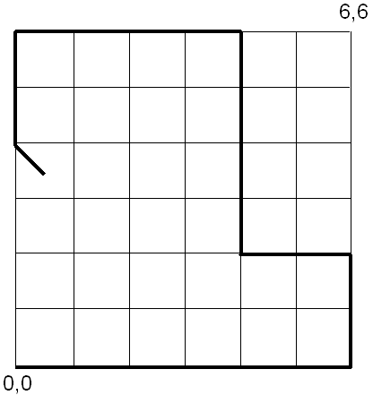
  1. Using ASCII files, create a line file to test how Idrisi handles the ambiguous conditions (i.e. lines on grid lines) when it rasterizes the point file. .

  2. a) Provide the contents of the ASCII line file you used and a snapshot of the final raster image with the line overlay.
    b) Describe how Idirisi rasterized various portions of the line.


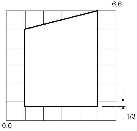
  1. Using ASCII files, create a polygon file to test how Idrisi handles the following conditions when it rasterizes the point file. .

  2. a) Provide the contents of the ASCII polygon file you used and a snapshot of the final raster image with the polygon overlay.
    b) Describe how Idirisi rasterized the polygon vector data.
  1. would suggest saving this file to a subdirectory on your N: drive. This lab should not take up much disk space so you should be able to use this as your Idrisi environment. This file contains an ESRI shape file (and supporting files). This is a small portion of a geology map. One of the items in the attribute table for the geology map is SYMBOL. Several polygons have SYMBOL = 217 and this is the group of polygons that will be the subject of your investigation. The goal is to compare the total area of the polygons with SYMBOL = 217 to the rasterized version of this geology at different pixel values. You will be rasterizing this geology map with 50, 250, 500, 1000, and 1500 m. pixels.

  2.  
      a) Provide a table and graph of Area Error vs. Pixel size for these polygons.

      b) Provide a table/graph of file sizes for a binary and packed binary version of the images vs. pixel size.

      c) Comment (in a paragraph or two) on the the graphs you created and discuss one example of the impact pixel size might have on analysis using the rasterized geology.

      You will be using the following commands: SHAPEIDR, INITIAL, POINTRAS, LINERAS, POLYRAS, AREA, and Database Workshop.


Back to Contents